Sea cliffs as tall as a skyscraper, beaches where the only footprints are yours and castles that have been standing with their feet in the water for centuries. The Wild Atlantic Way follows Ireland’s entire west coast, from Kinsale in the south to the Inishowen Peninsula at the top, and it’s one of the longest signposted coastal routes on the planet.
We drove a big chunk of it with our two kids, from Kinsale all the way up to Sligo. We got a storm, a surprise heatwave, about fifteen basking sharks right off the beach and rain. Lots and lots of rain. It wore us down so much that we cut the trip short. And yet this coast gave us some of our best memories of Ireland.
In this blog you’ll find out what the Wild Atlantic Way is, how to plan your drive, and the 18 stops we loved most, from south to north.
What is the Wild Atlantic Way?
The Wild Atlantic Way is a touring route of roughly 2,500 kilometres along the west coast of Ireland. It passes through nine counties, from Kinsale in County Cork to the village of Muff on Inishowen in Donegal, right by the border with Northern Ireland. It opened in 2014, and it isn’t one road but a chain of existing ones, from regional roads to lanes barely wide enough for a single car.
You hardly need a map. Blue signs with a white wavy line point the way everywhere, marked N or S for north or south. Along the route you’ll pass 188 Discovery Points: viewpoints and stops worth pulling over for, usually with a small car park and an information board.
Fifteen of them are Signature Discovery Points, the real showstoppers. Mizen Head, the Cliffs of Moher, Keem Bay on Achill and Downpatrick Head are all on that list.
What is the Wild Atlantic Way known for?
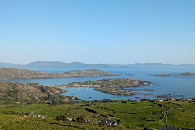
The Wild Atlantic Way is known for dramatic cliffs, empty beaches and a coastline that keeps changing. Within a few days you go from pastel fishing towns to bare limestone, bogland and mountains dropping straight into the sea.
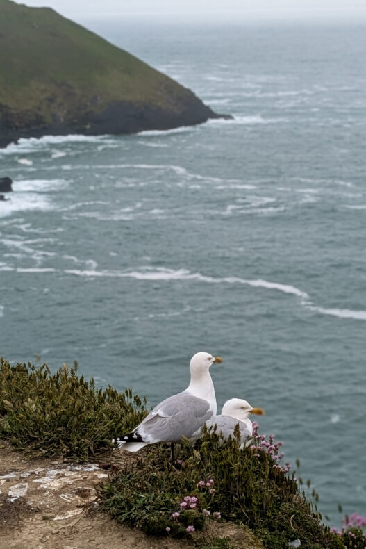
The Cliffs of Moher are the best-known cliffs, but the Kerry Cliffs, the rock walls at Portacloy and Slieve League in Donegal are every bit as dramatic. In many places there’s no fence, just you, the wind and the gulls.
Tucked between those cliffs are beaches you’d never expect in Ireland. In the sunshine, Barley Cove and Derrynane could pass for southern Europe, and at Inny Beach and Rinroe we had the sand practically to ourselves.
History lines the whole route: castle ruins like Carrigafoyle and Ballycarbery, the ancient monastery on Skellig Michael and Second World War markers laid out on the cliffs of Mayo.
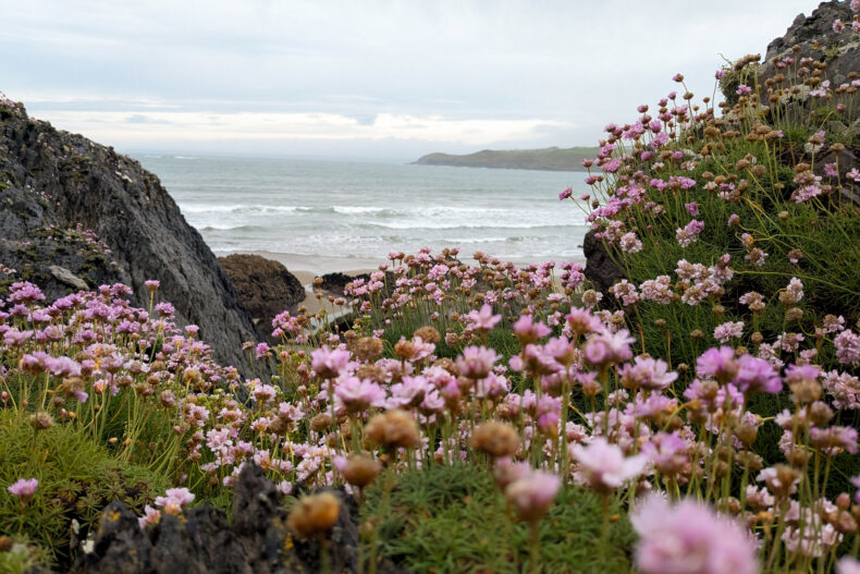
Often it’s the little things that make this route so incredibly photogenic. Sheep napping in the middle of the road, verges bursting with wild flowers, hillsides turned pink by rhododendrons and a picturesque tea room serving scones in every village. Those scones became the running theme of our trip.
Wild Atlantic Way tips
How many days do you need for the Wild Atlantic Way?
To drive the whole Wild Atlantic Way you need at least two to three weeks. Any less and you’ll spend most of it behind the wheel, because nobody drives fast on these roads. Most people pick one section and take their time.
A week is enough for the southern part, from Kinsale through West Cork to Kerry and Dingle. With two weeks you’ll make it to Galway or even Mayo. We took just over two weeks for Kinsale to Sligo, including a few washout days when we didn’t do much, and we could easily have filled another week.
→ Discover our 3-week Ireland road trip itinerary in 10 stops
When is the best time to drive the Wild Atlantic Way?
May to September is the best time for the Wild Atlantic Way. Evenings stay light until late, and in spring the wild flowers and rhododendrons are out. July and August are the warmest months, but that’s also when the queues build up at the Cliffs of Moher and on the Ring of Kerry.
Good weather is never guaranteed. It blows in straight off the Atlantic and can flip within the hour. We had a few days of over thirty degrees in Kerry and then mostly rain. A lot of rain. With two little ones in a small space we were stuck inside far more than we’d have liked, and in Galway we decided to head home early. So build in a few spare days and have a rainy-day plan ready, like a museum, a pub or a workshop.
Where does the Wild Atlantic Way start?
Most people start in the south, in Kinsale, about half an hour’s drive from Cork Airport. Most international flights land in Dublin, which is a few hours from the west coast. Shannon and Knock airports sit on the west coast itself, which is handy if you only want to drive the middle section.
Our tip: book your rental car through Discover Cars. It compares all the big rental companies in one go, so you can easily find the best deal.
Which direction should you drive the Wild Atlantic Way?
The route is signposted both ways. We drove clockwise for the whole trip, so south to north along the west coast. That worked well: you start with the gentle towns of West Cork and the scenery gets wilder and emptier the further north you go. That way you save the wildest part, Donegal, for last.
What is it like driving the Wild Atlantic Way?
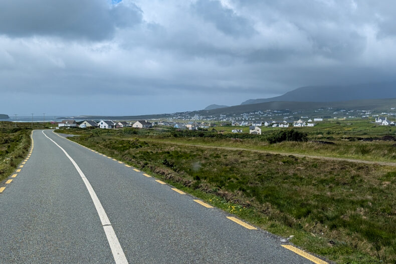
Ireland drives on the left, and you’ll get the hang of it sooner than you think. The roads themselves are the bigger challenge. Long stretches are narrow and twisty, with stone walls or hedges right up to the tarmac, and on the smallest lanes you’ll sometimes have to reverse to let someone pass. Expect a low average speed and don’t rent a car that’s too big.
We drove our six-metre campervan and got through everywhere, though a few coastal lanes had us holding our breath. On the Ring of Kerry the tour coaches go anticlockwise. Drive the other way, like we did, and you’ll meet them head-on instead of crawling along behind them for hours.
→ Read all our tips for renting a car and driving in Ireland
→ Read all our tips for Ireland by campervan
Where to stay on the Wild Atlantic Way
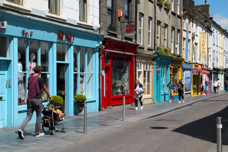
Good bases along the route are Kinsale, Kenmare (for the Ring of Kerry), Portmagee (for the Skellig Ring), Dingle, Doolin (for the Cliffs of Moher and the Burren), Galway, Westport (for Achill and Mayo) and Sligo. Try to stay two nights in each place, so you’re not repacking every single morning.
Our favourite places to stay, from south to north:
#1 Giles Norman Gallery & Townhouse has just a handful of rooms above a gallery full of Giles Norman’s black-and-white photography. The harbour and Kinsale’s seafood restaurants are a few minutes’ walk away.
#2 Brook Lane Hotel is a small, friendly hotel on the edge of Kenmare, where the Ring of Kerry meets the Beara coast. You can walk to the pubs in town.
#3 The Moorings sits on the harbour in Portmagee, the fishing village where the boats leave for the Skelligs. The Kerry Cliffs are a few minutes’ drive away and the Skellig Ring starts on the doorstep.
#4 Castlewood House looks out over Dingle Bay, a short walk from the town centre. Perfect for a pint after a day on the Slea Head Drive.
#5 Hotel Doolin is a handy base for the Cliffs of Moher and the Burren. You can walk the coastal path to the cliffs, and in the evening there’s live music in the pubs nearby.
#6 The g Hotel in Galway is impossible to miss, with over-the-top interiors by milliner Philip Treacy in pink, purple and mirrors. After a soggy day, the spa is a great place to thaw out.
#7 The Wyatt Hotel is a classic hotel in the middle of Westport, a lively market town full of pubs and little shops. Achill Island and the empty north coast of Mayo are an easy drive away.
#8 The Glasshouse is the building with the glass front on the river in Sligo, so you won’t miss it. Benbulben and the Gleniff Horseshoe are about half an hour’s drive.
The 18 best stops on the Wild Atlantic Way
These are our 18 favourite stops, from south to north, in the order you reach them if you drive clockwise.
#1 Kinsale and the Old Head of Kinsale: where the route begins
Your first miles on the route start in Kinsale, a fishing town of pastel houses famous for its seafood. We were unlucky: low cloud hung over the marina and the houses looked a lot greyer than on the postcards. We tried the coastal path to star-shaped Charles Fort, but gave up halfway when the heavens opened again.
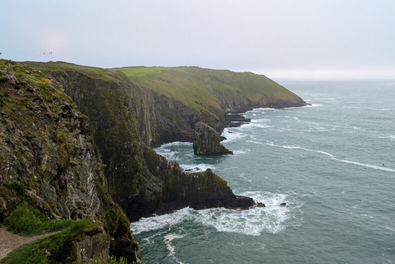
South of town, the Old Head of Kinsale sticks out into the ocean like a long finger. Since the 1990s most of it has been a private golf course, so you can’t get to the lighthouse at the tip. We drove as far as the golf resort and took in the cliffs from there. Even with rain on the windscreen, it was a good first stop.
→ Discover the 11 best things to do in Cork
#2 Clonakilty and Red Strand: scones and a beach that grows at low tide
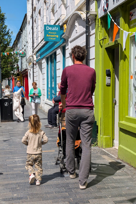
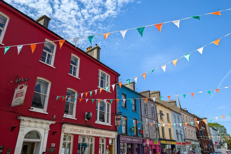
The next day the sun finally came out, and Clonakilty instantly became our favourite town in Cork. Bunting hung over the streets, the terraces were full and there were little shops between the painted houses. In a tea room that’s pink from top to bottom, the four of us shared one huge plate of scones with jam and cream. The kids finished the afternoon in the playground.
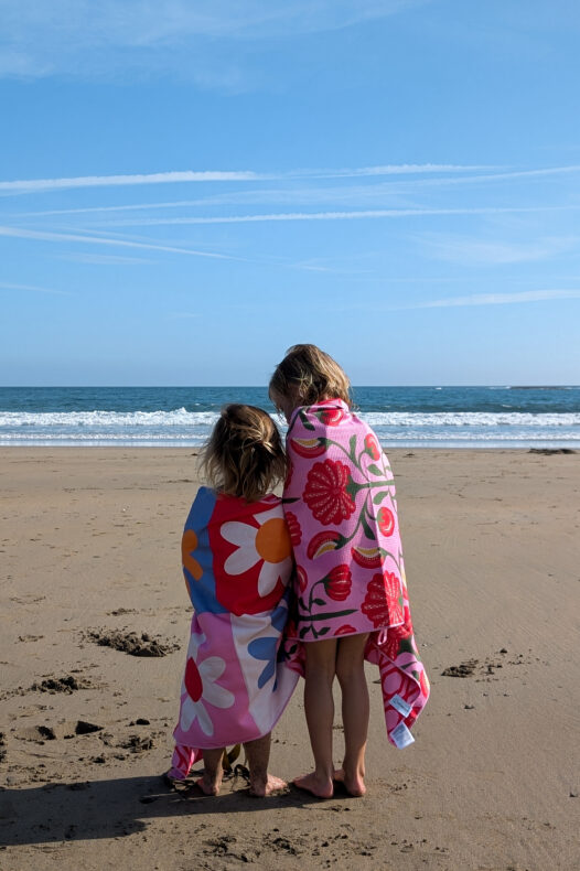
Just outside town is Red Strand. At high tide it’s a modest bay, but once the water goes out, a huge stretch of sand appears. The kids spent the whole morning running in and out of the waves. A bit further on, wild Dunworly Beach all but vanishes at high tide.
#3 Mizen Head: the southwestern tip of Ireland
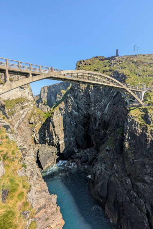
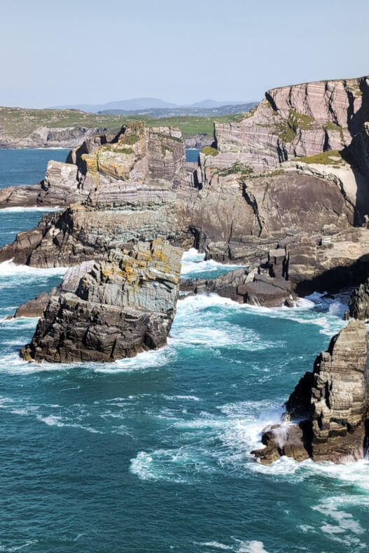
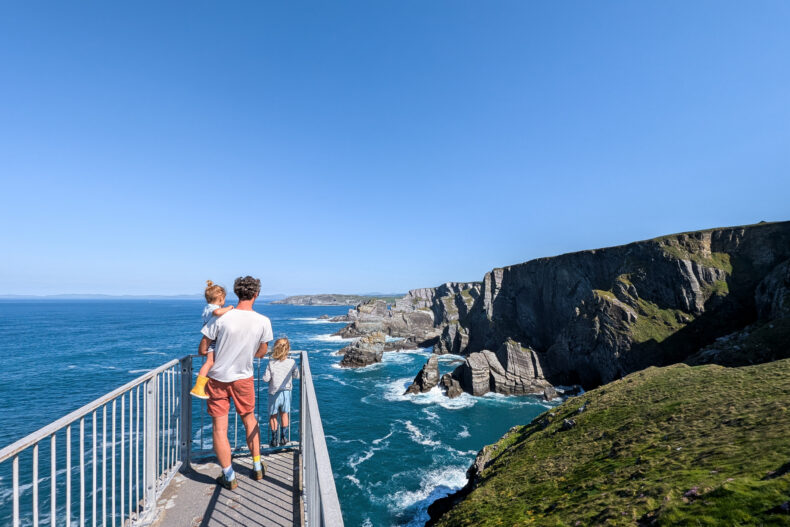
The far southwest of Ireland feels like the end of the world. From the car park at Mizen Head, steps and paths lead down to a concrete bridge slung across a deep gorge. On the other side is the old signal station, clinging to the last rocks before the ocean. We were leaning on the railing to watch the waves when a dolphin popped up below us.
We’d seen plenty of photos of the bridge, but the little museum in the station was a nice bonus. Old objects and stories show how the keepers lived out here, warning ships off this treacherous coast. The bridge, paths and station are all part of a visitor centre with an entrance fee, so they also have opening and closing times. We didn’t know that beforehand, so around sunset we found ourselves at a closed door. Luckily we could come back the next morning for a second try.
#4 Barley Cove: the best beach of our trip
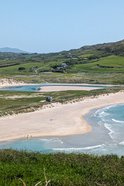
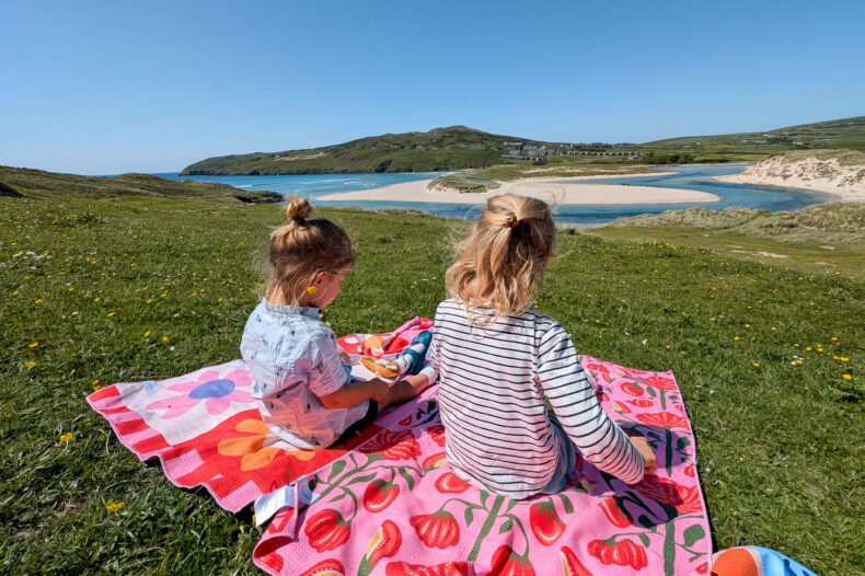
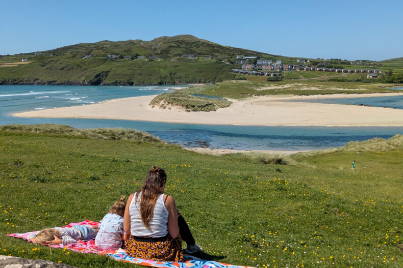
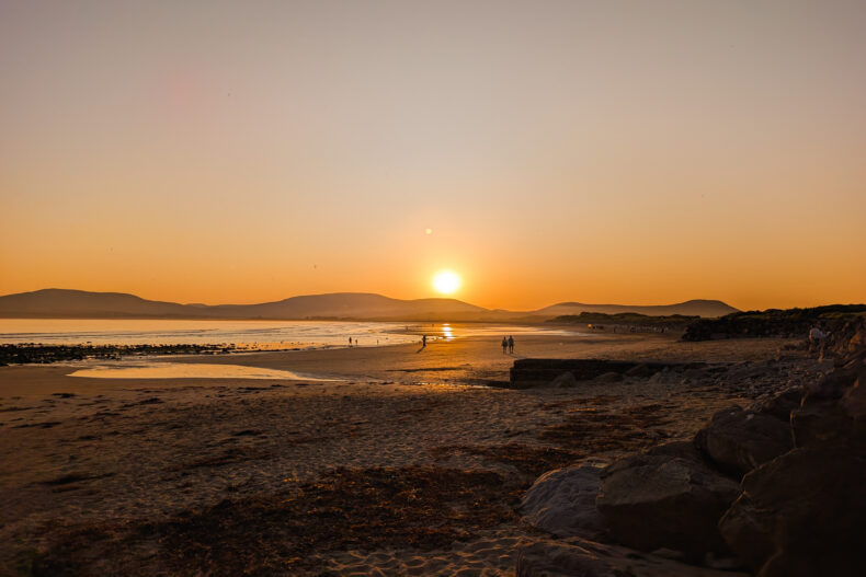
On the road to Mizen Head you crest a hill and the sweeping Barley Cove lies below you: white sand, dunes and a little river looping its way to the sea. It looked so exotic that we had to remind ourselves which country we were in. Of all the beaches on this trip, this was our number one.
It was only meant to be a lunch stop. We had a picnic in the grass above the bay, but then wandered down to the sand for a bit. There’s usually a floating bridge across the lagoon to the other beach to keep your feet dry, and at low tide you can simply wade through the shallow water.
#5 Derrynane Beach and Inny Beach: tropical vibes in Kerry
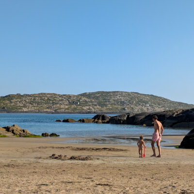
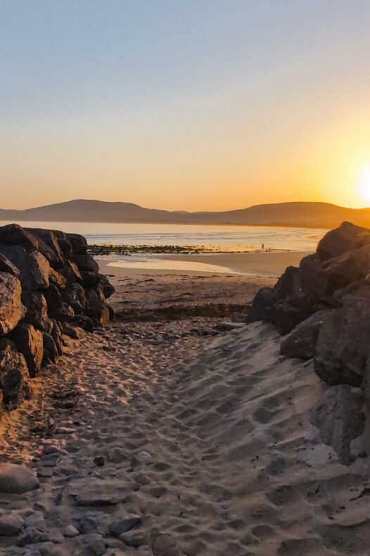
In Kerry the weather turned, but this time towards the heat. On my birthday in Sneem the thermometer hit 31 degrees, so we waited until about five o’clock before heading to Derrynane Beach. Worth the wait. A long curve of white sand, water as clear as a swimming pool and rocks for the kids to climb. We went for a swim and stayed until the sun was almost down.
At low tide you can walk from the beach to Abbey Island, with the remains of an old abbey and a graveyard. The parkland behind the beach belongs to Derrynane House, once the home of Irish political leader Daniel O’Connell.
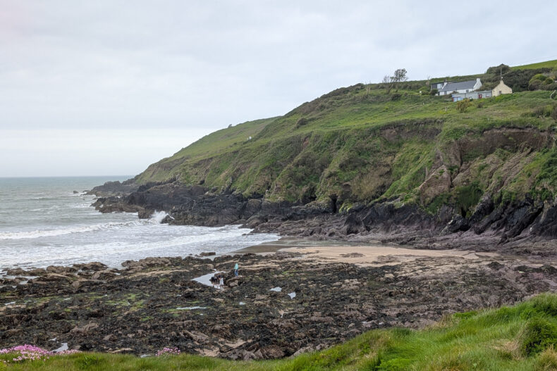
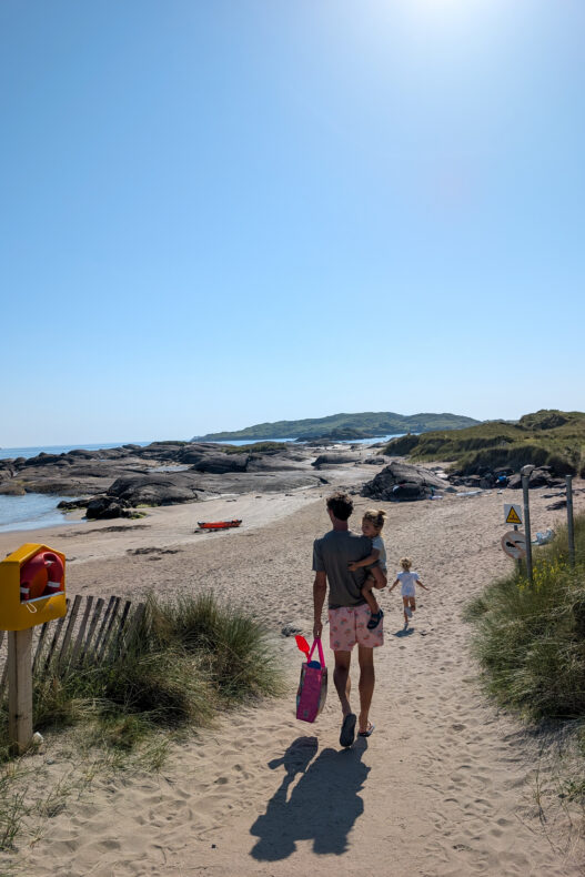
A little further north is Inny Beach, a long strand where you rarely see anyone. Not on our first evening, though: a film was being shot, horses, crew and all, and suddenly the place was crowded. By the next morning everyone had gone and we had the whole beach to ourselves.
→ Discover the 10 best stops on the Ring of Kerry
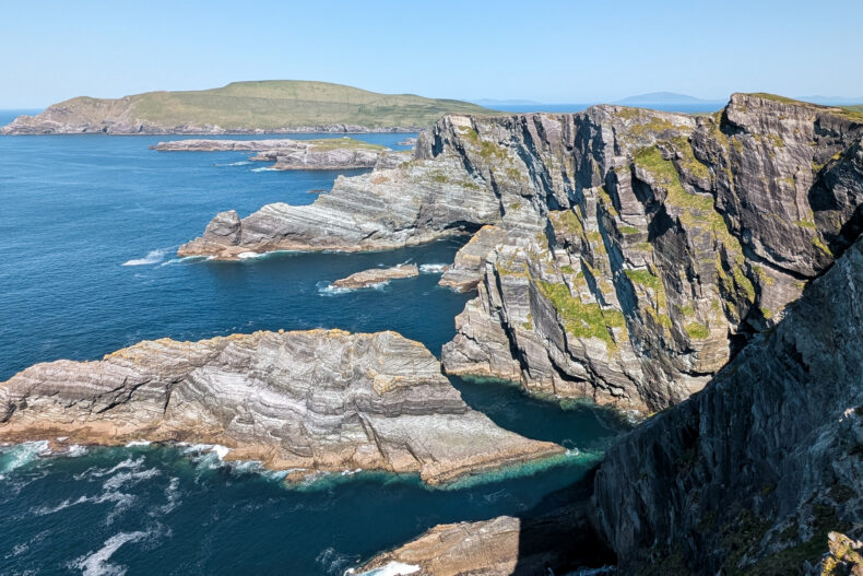
#6 The Kerry Cliffs and the Skellig Ring: views of Skellig Michael
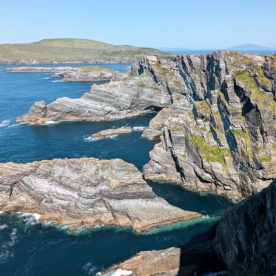
From Portmagee you can add a little extra loop: the Skellig Ring. It’s narrower than the Ring of Kerry, there are no coaches and if you ask us, the scenery is even better. Only the Coomanaspig Pass is a proper climb, steep and narrow, but even our campervan made it over just fine. The star of the loop is the Kerry Cliffs, a rock face dropping more than three hundred metres straight into the sea. We walked to the viewpoints in blazing sunshine and thought they easily matched the Cliffs of Moher. You won’t be alone, but it’s nothing like a crowd.
Out at sea, the two Skellig islands rise like shark fins, with Puffin Island closer to shore. On the larger island, Skellig Michael, monks lived over a thousand years ago in huts of stacked stone, high on the rock and reachable only by hundreds of steps. Landing is only possible in summer, with a few boats a day and no children under twelve. Boat trips around the island run too.
→ See the boat trip around Skellig Michael from Portmagee
#7 Ballycarbery Castle: a castle ruin in the evening light
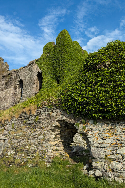
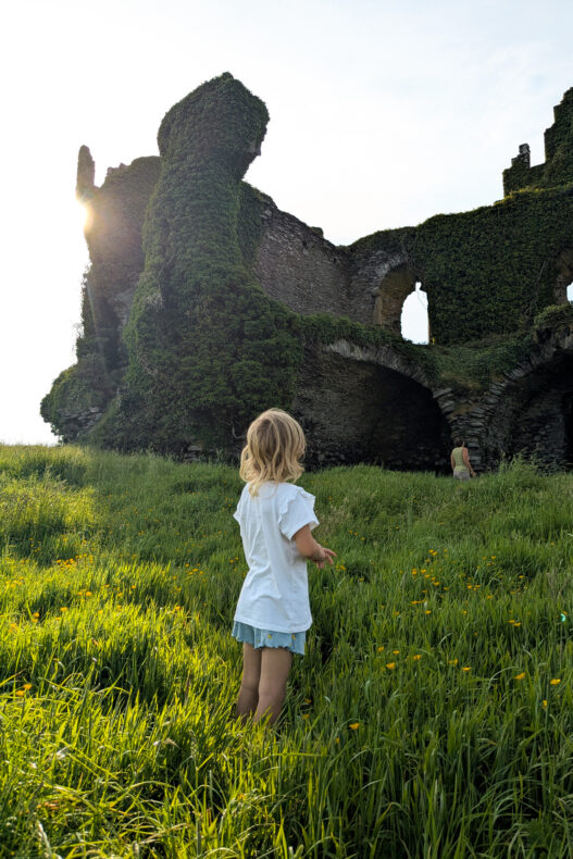
Our best moment in Kerry came near Cahersiveen. That’s where you’ll find Ballycarbery Castle, a crumbling fortress almost swallowed by ivy, standing in the fields by the water’s edge. You’re on private property here, so check the signs by the gate for what you can and can’t do.
Beside the castle is a shallow tidal flat that nearly empties at low tide. As the sun went down, tractors rumbled across it to the shellfish beds further out. The beach nearby had been too busy and too hot during the day, so only in the evening did we properly relax: coffee in hand, castle glowing orange.
#8 The Slea Head Drive: Minard Castle, Dunmore Head and Coumeenoole
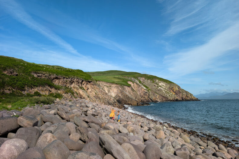
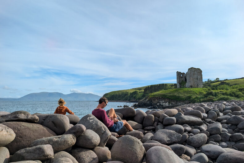
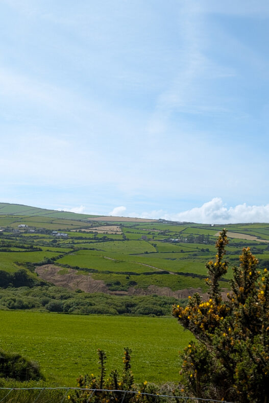
The Dingle Peninsula is smaller than the Ring of Kerry peninsula but rougher, and in many villages you’ll still hear people speaking Irish. We started on a beach of round boulders next to the ruins of Minard Castle. The kids were kept busy for ages.
Then we headed to the western tip and followed the Slea Head Drive, the coast road that wraps around the headland. At times there’s only room for one vehicle, with rock on one side and sea on the other. So follow the signs and drive it clockwise. You’ll pass stone huts shaped like beehives, with the Blasket Islands in view nearly the whole way. We did skip the Conor Pass, the mountain road from Dingle to the north coast: it’s off limits to anything over two tonnes, campervans included.
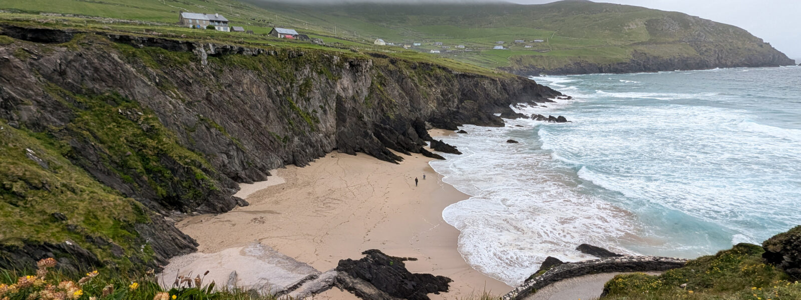
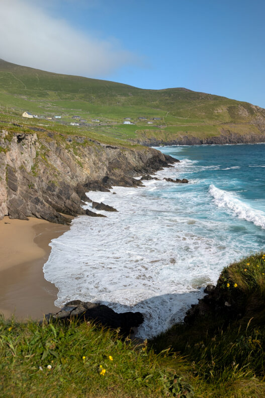
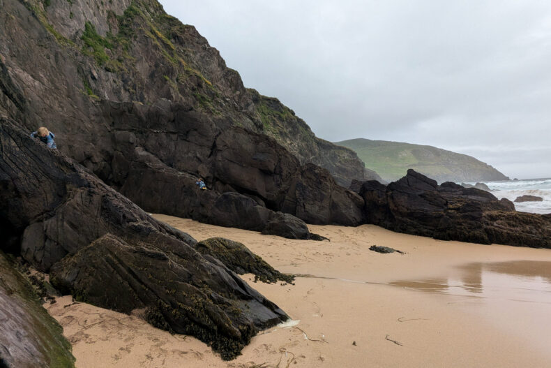
Dunmore Head is the westernmost point of the Irish mainland. Below it lies Coumeenoole Beach, a small sandy cove hemmed in by black rocks, where the waves really put on a show. A path from the beach climbs up for the best view of the islands. To see them up close, take a boat from Dingle harbour.
→ See the boat trip along the Blasket Islands from Dingle
#9 Dunquin Pier: the zigzag path to the Blasket boat
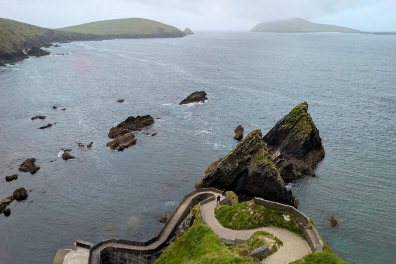
A few kilometres on is Dunquin Pier, one of the most photographed spots on the Slea Head Drive. A narrow path zigzags down the cliff to the little jetty where boats leave for Great Blasket. It’s pretty touristy, but the view from the top over the winding path and the rocks in the sea is gorgeous.
Great Blasket was inhabited until the 1950s. Then the last islanders moved to the mainland, but their stories live on in the books several of them wrote in Irish.
#10 Carrigafoyle Castle and the Shannon ferry
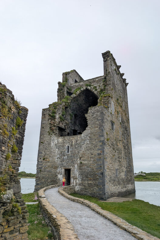
Near the mouth of the Shannon, Carrigafoyle Castle rises straight out of the water. The O’Connor family built the slender tower in the late fifteenth century to keep an eye on ships on the river. During a siege in 1580, English forces blasted a hole in it, and that gaping gap is still there today.
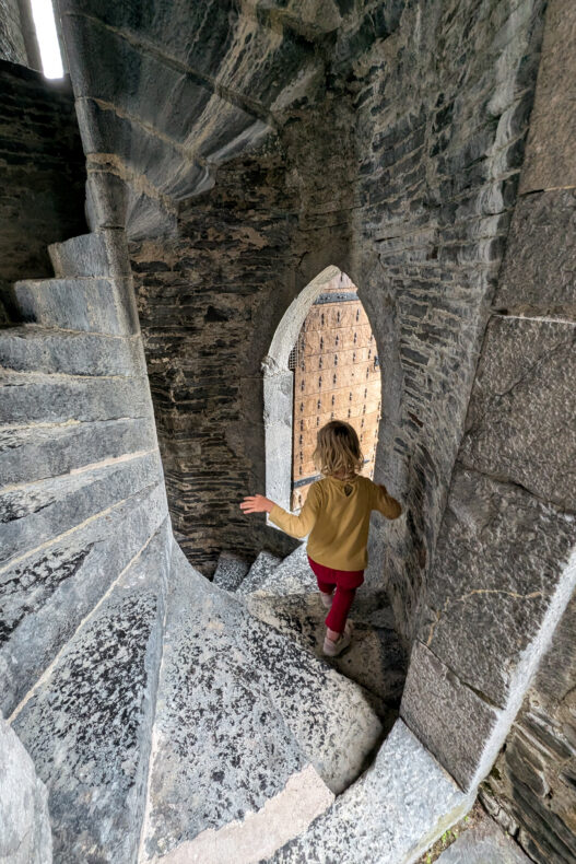
One look wasn’t enough: we explored it in the afternoon and returned first thing the next day. A tight stone spiral staircase takes you to the top, with views over the river and green fields in every direction.
A short drive on, the car ferry leaves Tarbert for Killimer in County Clare. The crossing only takes about twenty minutes and saves you a long detour via Limerick. We didn’t find it cheap. Buying your ticket online is a little cheaper than paying at the quay, so we quickly booked on our phone in the car park.
#11 Cliffs of Moher: impressive, but crowded
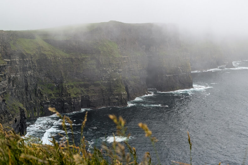
As a child I had a bookmark with the Cliffs of Moher on it, and ever since, that picture meant Ireland to me. So after all those years, my hopes were high. For about fourteen kilometres, the Cliffs of Moher rise more than two hundred metres above the Atlantic.
In real life they let us down. It was heaving with people and pouring with rain, and we saw little more than a grey edge. The puffins were just dots on distant rocks. You buy a ticket per person at the car park, which also covers the visitor centre and the paths. Because the cliffs themselves are public, you’ll often see cars dropping off passengers just before the barrier.
The big visitor centre shows a free film where you swoop along the cliff face like a seabird, which was the highlight for us. Personally, I found the Kerry Cliffs and Portacloy more impressive, and we shared the views with far fewer people there.
Still want to go? We get it. Wait for a dry day, and aim for early morning or late in the day. For a quieter experience, walk part of the coastal path from Doolin. Or see the cliffs from the water, on the boat that sails from Doolin along their base.
→ See the Cliffs of Moher boat trip from Doolin
#12 The Burren: a moonscape with sheep
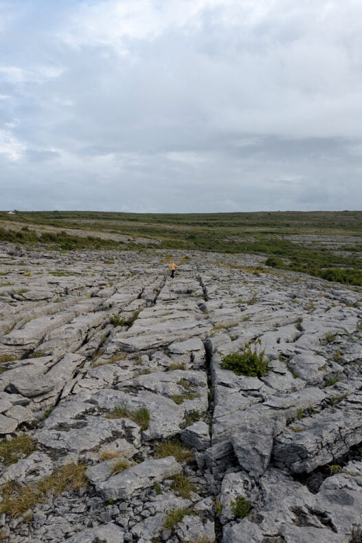
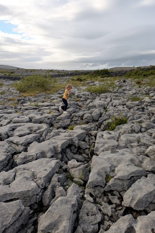
North of the cliffs, County Clare turns into a lunar landscape. In The Burren, vast slabs of grey limestone run all the way to the shore, full of cracks and crevices. Inside them grow plants you’d never expect here, from orchids to species you’d normally find in the mountains or around the Mediterranean.
We parked at a viewpoint and Sebastiaan took the kids up onto the limestone. They didn’t follow a route, they just roamed between the cracks and the little flowers.
One of the best-known sights in the area is the Poulnabrone dolmen, a tomb around five thousand years old: a flat capstone balanced on upright stones, like a table for a giant.
#13 Galway and Kilcolgan: the city and a scone workshop
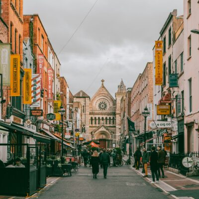
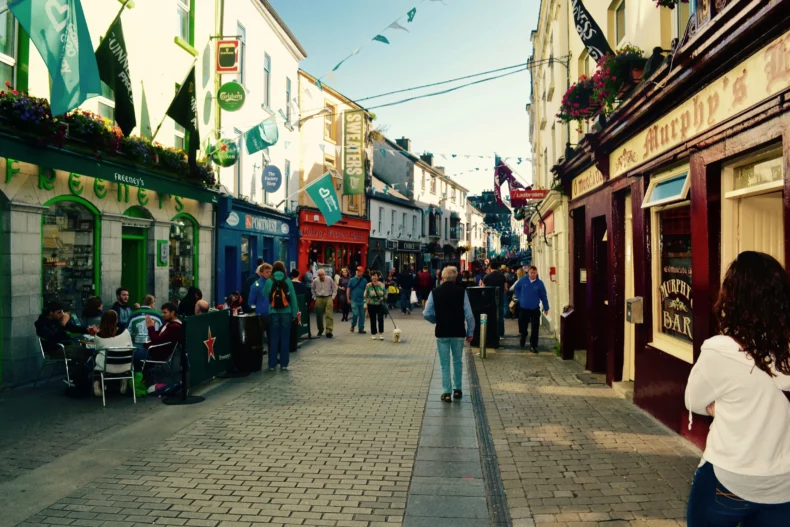
Galway is where the west comes alive. In the lanes of the Latin Quarter, with their brightly painted fronts, there are buskers everywhere, and in the evening many pubs have live Irish music. Galway is also the easy gateway to the Aran Islands, three bare limestone islands where Irish is still the everyday language. On Inis Mór you can rent a bike and ride between miles of stone walls to Dún Aonghasa, an ancient fort on a cliff edge.
→ See the day trip by ferry to Inis Oírr
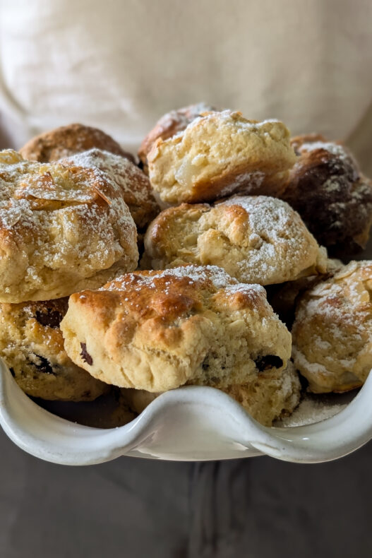
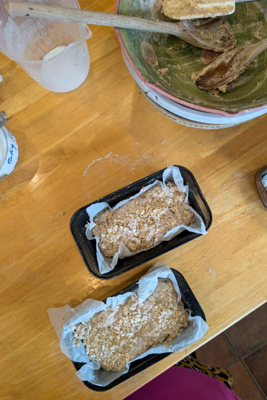
We skipped the city itself. It had been raining for days, the four of us were getting cabin fever and we were about to drive straight to the ferry in Dublin. What cheered us up was a workshop just outside town, in Kilcolgan. Kate welcomed us into her own kitchen and showed the whole family how to bake Irish scones and brown bread (as guests of GetYourGuide). Everything that came out of the oven, we got to eat warm. You can’t ask for much more on a rainy day.
→ Book the scones and brown bread baking class with Kate
We settled on a compromise: a few more days on the west coast, then home. Best decision ever, because the northwest turned out to be some of the most beautiful country we saw in Ireland.
#14 Connemara and Killary Harbour: Galway’s wild west
Drive northwest from Galway and you’re in Connemara: bog, lakes, bare peaks and a jagged coastline with small white coves, all under the mountain range of the Twelve Bens. Many people see this as the most typically Irish landscape of all. Near the town of Clifden, the Sky Road is a short loop high above the sea.
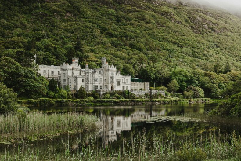
Further north, Kylemore Abbey stands by a lake beneath wooded slopes, a neo-Gothic castle that has been home to Benedictine nuns for more than a century. On the border with Mayo, Killary Harbour cuts sixteen kilometres inland, a narrow sea inlet often called Ireland’s only fjord.
→ See the full-day Connemara tour with Kylemore Abbey
#15 Achill Island and Keem Bay: sheep on the road
Achill Island is Ireland’s biggest island, yet you get there without a boat: a short bridge links it to the mainland. Still, it feels like an island straight away. Trees become rare, the mountains turn bare and sheep wander wherever they like. Some were happily grazing in people’s front gardens.
Keem Bay is the island’s jewel. You reach it along a narrow road high above the rocks, and down below is bright blue water between green hills. On the way, near Keel, you’ll pass a stone circle for meditation, a waterfall and the Cathedral Rocks, jagged formations the sea slams into. That’s exactly where a massive downpour caught us. Dripping wet, we ran for cover, and our daughter knew just what we needed: hot chocolate. No view could beat that.
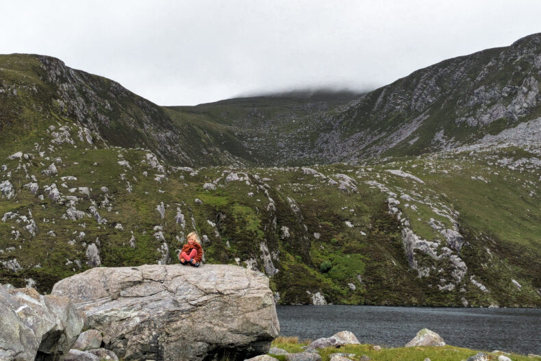
Sebastiaan wasn’t going to let the rain stop him and still climbed part of Croaghaun, starting at the little Lough Acorrymore reservoir. When the sky is clear, the summit overlooks sea cliffs that rank among Europe’s tallest. He mainly stared into a wall of cloud.
#16 Portacloy and Rinroe Beach: cliffs and basking sharks
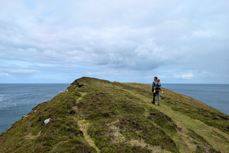
You’ll hardly see another tourist along the north coast of Mayo, and that emptiness is what makes it special. One of our best days of the trip began on the Portacloy Cliff Walk. It isn’t long, but it’s stunning, past sheer cliffs and sea stacks. On the clifftop, the word ÉIRE is spelled out in white stones next to a number. During the Second World War these markers were laid all along the coast, so pilots knew they were over neutral Ireland.
After lunch a man came up to us. He’d seen there were basking sharks in the next bay, at Rinroe Beach. We drove straight there and watched about fifteen basking sharks for hours, cruising just below the surface with their enormous mouths wide open. Twice, one shot right out of the water. There’s nothing to be scared of, by the way: only the whale shark is bigger, and their entire diet is plankton.
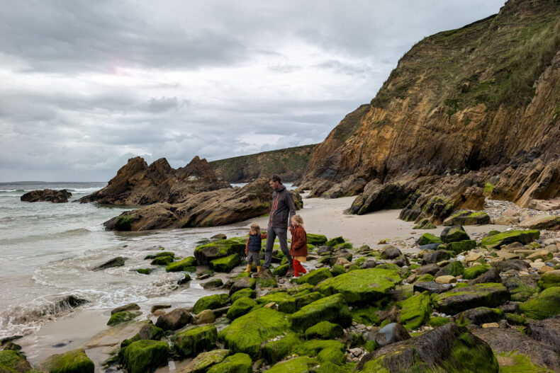
Even without sharks, Rinroe is a beautiful beach, with rocks and caves to explore and curious sheep coming over to see what you’re up to.
#17 Downpatrick Head: a sea stack and a blowhole
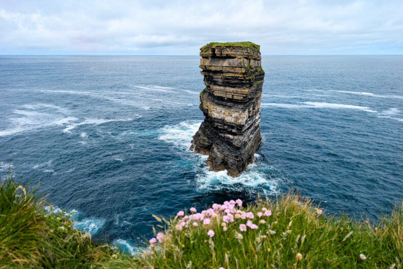
At Downpatrick Head, one of the Signature Discovery Points, the sea stack Dún Briste stands just off the cliff. It’s over forty metres tall, with layers of rock running through it like a layer cake. Legend says Saint Patrick struck it from the mainland with his staff. Amazingly, it stayed dry during our visit.
A little further along is Poll na Seantainne, a hole in the grass where the ocean surges in through an underground tunnel. We thought it was every bit as impressive as the sea stack.
#18 Sligo: Benbulben, the Gleniff Horseshoe and a Mass Rock
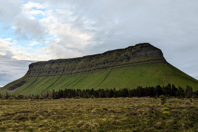
It looks as if someone took a knife to it: Benbulben, Ireland’s most famous flat-topped mountain, sits like a giant block of rock above green County Sligo. It features in the work of W.B. Yeats, and the poet chose a churchyard in its shadow as his final resting place. Our morning walk below its steep flanks ended soaking wet, and soon the whole summit had vanished into cloud.
Behind the mountain lies the Gleniff Horseshoe, a road of about ten kilometres that curves through a valley in the shape of a horseshoe. Steep rock walls tower all around and waterfalls pour down from every side. Thanks to the rain that fell nearly all day, they were in full flow. For us, this was some of the finest nature we saw in Ireland.
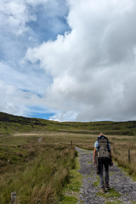
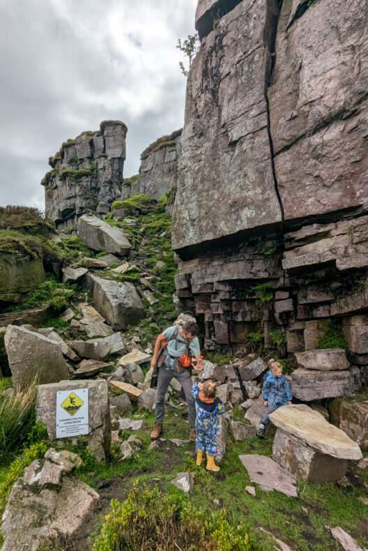
When we were already heading back to Dublin, we made one more stop in the hills south of Sligo. The trail to a Mass Rock turned out to be one of our favourite walks of the trip. A Mass Rock is a remote rock that served as a secret altar in the seventeenth and eighteenth centuries, when Catholic services were banned. Boardwalks and big boulders take turns, with open views stretching far into the distance. On the way back the rain came down in buckets, but it didn’t spoil a thing.
Pack insect repellent for Sligo. When the wind drops, the midges come out: tiny biting flies that even found their way in through the campervan’s air vents.
Bonus tip: Donegal, Slieve League and Malin Head
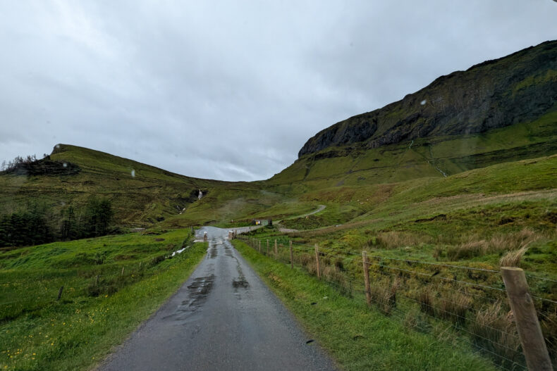
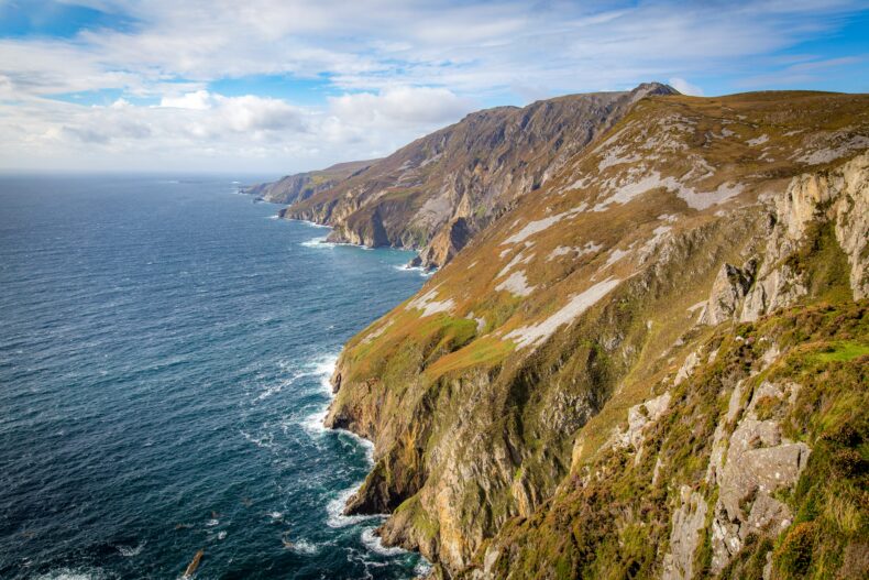
The northernmost part of the Wild Atlantic Way runs through Donegal, the wildest and emptiest corner of Ireland. This is where you’ll find the cliffs of Slieve League, around six hundred metres high and among the tallest sea cliffs in Europe, almost three times the height of the Cliffs of Moher. A short path leads to the viewpoint, and if you’re brave you can carry on along the narrow ridge of One Man’s Pass.
Right at the top is Malin Head on the Inishowen Peninsula, the northernmost point of the island. From there it’s not far to Muff, where the route ends. We didn’t make it that far north this time, so Donegal is first on the list when we come back.
→ Discover the 20 best places to visit in Ireland
→ Discover the 20 best things to do in Dublin
More tips for the Wild Atlantic Way
 Our pickStill looking? Browse all hotels in Galway, a great base on the west coast
 Driving the west coast? Rent a car with Discover Cars and compare the big rental companies in one go.
 Fancy doing it by camper, like we did? Rent a campervan with Campervan Planet and wake up by the sea.
 No flight yet? Compare flights to Dublin, Shannon or Cork.
 Discover all our blogs about Ireland